Block Name
Tiroa E
Area (Hectares)
6084.11
Māori Land Court District
Waikato-Maniapoto
LINZ Certificate of Title
SA51C/863


Access

Access to the block

Access to infrastructure

Data sources and information

Climate
Temperature

Air temperature

Growing Degree Days

Frost days
Conditions

Sunshine

Rainfall

Wind

Data sources and information
Water

Surface water

Waterways

Riparian zones

Groundwater

Irrigation
Data sources and information


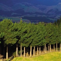
Slope
Erosion

Aspect
Aspect (ha)
Data sources and information
Data sources and information

Soil drainage

Permeability

Soil water capacity

Potential rooting depth

Data sources and information


Land use capability
Land use capability (ha)

Papakāinga

Capital and funding opportunities
Data sources and information

People (2018 Census)

Māori freehold land
Social (2018 Census)
Households
Highest Qualification
Employment status
Data sources and information


About this report
Te Puni Kōkiri wants to help whānau to start and continue conversations about the whenua. Sometimes that can be hard — whānau often live a long way from the block or don't have access to land information.
This report is an overview of a selected Māori freehold land block. It brings together data and information from a range of places including:
Manaaki Whenua Landcare Research
Ministry for the Environment (MfE)
It also includes links to helpful tools and resources.
Understand the limitations of this report
The goal of this report is to provide general information to help start and inform conversations. It is not comprehensive or detailed enough to support detailed decision-making.
The information in this report comes from lots of different places. Some datasets are older than others but are still useful to get an idea of what might be possible or not.
You should always check things out on the ground before making big decisions.
Review the Tupu.nz general disclaimer that also applies to this report
Review the Tupu.nz copyright information that also applies to this report
Get advice from experts
Kaimahi at Māori Land Court can help with information about your options with formal governance structures.
Te Puni Kōkiri also have regional advisers who can visit your whenua and help you work out what the best option might be.
You could also get advice from other experts, like land advisors, financial advisors, lawyers, and other trusts. There may be funding available to help with this.
Next steps
Consider the potential of the whenua
Work out whānau aspirations for the whenua
Search the land use fact sheets
Search for funding opportunities
Find your local Te Puni Kōkiri office